Wednesday 26 February 2014

Mt. Connection

Yesterday we walked to Mt. Connection from Big Bend on Mt. Wellington. It was a beautiful, warm day and several stops were taken to remove excess clothing.

The track starts out on an old fire trail that was a delight to walk both going and coming. I say that with tongue well and truly in cheek as it is loose rubble and gets steep in places. It starts to flatten near the bottom and that's where we turn off on the marked Mt. Connection & Collins Bonnet track.

Ready for the off


Here come some more


Fire Trail


Turn off to Mt. Connection


track


This track passes through Snowgums and has some rocks but not as many as the Thark Ridge track. We leave the trees behind and cross a valley to the bottom of Mt. Connection on duckboard to a pretty little clearing where morning tea was had.

From there we went up Mt. Connection, not a steep climb but becomes very rocky at the top. Lunch was had on a rock outcrop complete with Jack jumper ants, who were not happy campers. These little beauties have a very powerful venom and can cause serious problems to someone who's allergic. According to what I've read they kill someone roughly every 4 years.

After lunch we made our way back while admiring the views behind us. At least that's the excuse I used for frequent stopping on the way back up that fire trail.

Across valley


Looking around


Morning tea


Derwent River North of Hobart


Start of big rocks

Where to now?

Rock hopping


We made it.

Typical bush


Banksia marginata


Report

We walked 8.3km and took 3.5 hours.

16 People took part. 

Click here to download GPX file

Wednesday 19 February 2014

Thark Ridge on Mt. Wellington

Yesterday we did the track along Thark Ridge, and if you want exercise for your legs, forget Stair Stepper machines as this is much cheaper. I doubt if there was more then a metre without stepping up/down on a rock.

However, it is a beautiful alpine walk and I'll try to identify photos of plants with more then my usual information of being green, brown, green & brown and green & brown with coloured bits. Seems I need to get a book on the vegetation, as little is available on the web. Anyone that can identify my photos, let me know and I'll update the blog.

Entry is behind main carpark on Mt. Wellington and the track is narrow through the bush and over scree, through Snow gum forests with many ghostly remains of the 1967 bush fires. This eventually takes us to the Municipal Carn which marks the spot where the corners of Kingborough, Glenorchy and Hobart Councils come together. Obviously not built by the said councils as they'd still be arguing about planning permission.

We had a small party on our morning tea break to celebrate Gordon's 82nd birthday. Gordon was our walk leader for the day and spent the day well in front of us mere mortals.

The weather remained dry, but there was low cloud in the distance that dissipated by the time we walked back, and turned into sunshine.

Next week we also leave from the same carpark and I think we are going into Mt. Connection. I know some were worried about the conditions of the walk and if it would require the same amount of rock walking as today. The following link provides a description and should set your mind at rest. It's a moderate walk.

http://www.sharemyroutes.com/routes/Australia/Ferntree-Tasmania/Mount-Connection/details.aspx


Up to the Ridge
Morning Tea is a serious business!

Happy Birthday to Gordon


Now that they're on the Web, everyone's a showman.


Snow Gum


Grows in clumps and will tear you to pieces.

Lunch at the Municipal Cairn
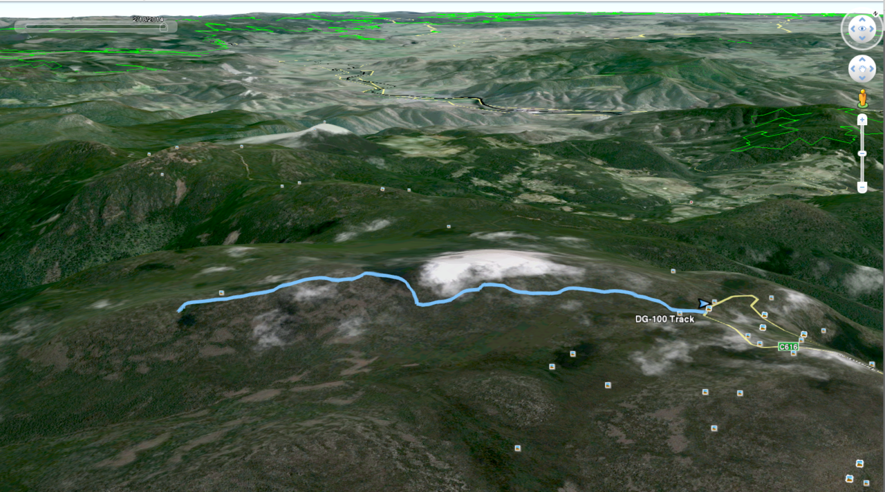
Google Earth

Thark Ridge. Notice Mt. Connection at top left

Report

14 walkers.
7.15km and just over 4 hours.

Thursday 13 February 2014

Kingston Beach & Alum Cliffs


Before I start, Carol has solved the mystery of the 'Interesting Fungus' photo of last week. I might point out that she also was the one who called our attention n the first place.

She casually ran the Latin name past me, but as I have enough trouble remembering who I am, Cyttaria gunnii or Myrtle Orange had no chance. It only appears on Myrtle Beech (Nothofagus cunninghamii), and is parasitic and edible.You're on your own there.

Kingston Beach & Alum Cliffs walk.
  
It was a beautiful day, as David said, "I wonder what the poor people are doing?". 

We parked down near the beach and walked south past the houses to the top of the hill and then turned left and down the track towards Boronia Point. There's a little beach I'm told is used by the local nudists - no luck today!

Start of Walk to cliffs

 It must have been the clear air & beautiful weather as we were a fairly unruly group today, and Our Dear Leader, Tas, had to come down hard on us.

We don't look all that unruly

Bob attempting a coup to take over walk leadership from Gordon

Heading north towards Kingston Beach

First evidence of damage from Sunday's wind storm

Southern end of Kingston Beach

Kingston Beach


 After walking the length of the beach we took the track up into the bush and found a comfortable place for morning tea.


From left, David, Tas, Carol, Gordon & Bob

You get a variety of country from open to ferns. This gully is usually wet, but not today.

Fern gully

 We turned left again  and continued up another track that passed through the old Brickfields from convict days.
 
You can just make out some old bricks lying in the bush


Story of Brickfields

 Of course, the local aborigines were here before us.


Some of the tracks

Back along the beach, heading south

We're heading for the white house just left of centre


View from veranda


  We had 16 people including an new recruit, Fran.  I have to confess that my GPS tracker shut down for some reason and I only have part of the walk. However I think it was about 7-8km. 

Thanks for all the good words re this blog.

Click here to download GPX file