Thursday 27 October 2016

Oakdowns-Rokeby Outstanding Views 2016

Today Bob is taking us on a new walk at Rokeby. The weather is perfect, sunny and warm.

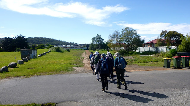
We park at the end of Princes Parade where Bob tells us the following about the walk.

1. No flowers - Botanists are disappointed
2. No wild life - Zoologists are disappointed
3. No ruins - Historians are disappointed
4. No bird life - Ornithologists are disappointed
5. Terrific views - Photographers are happy

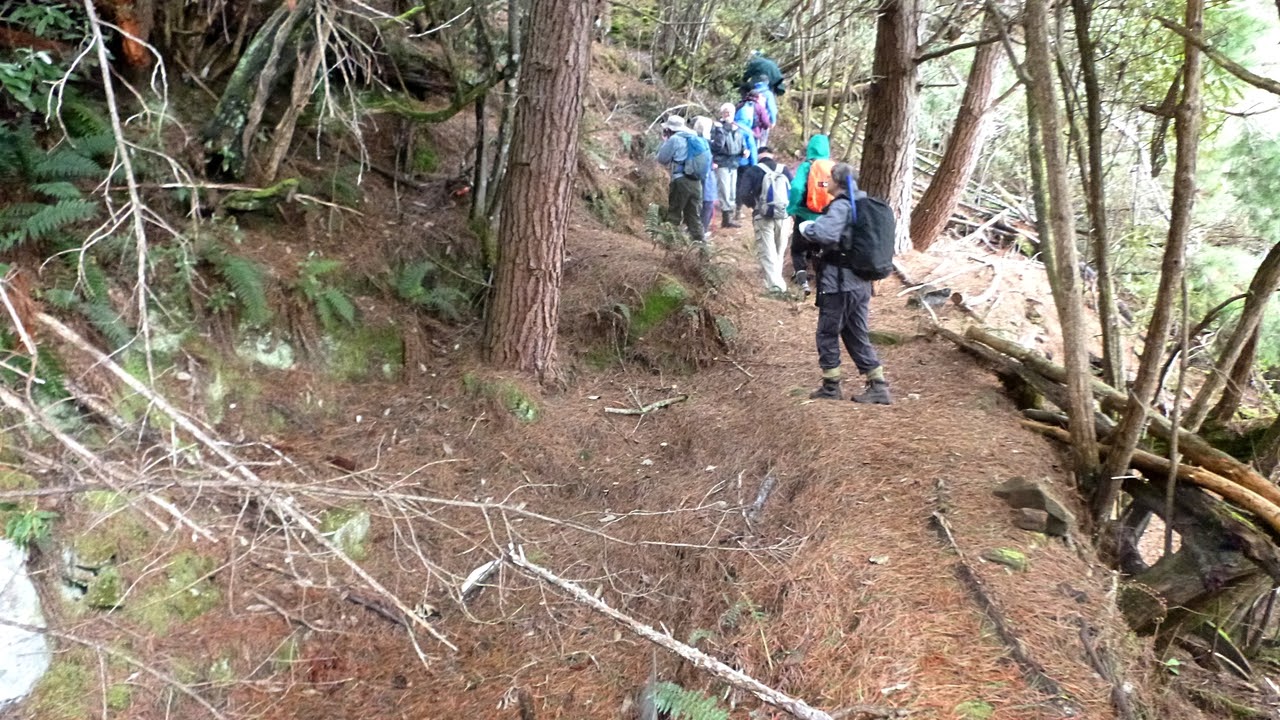
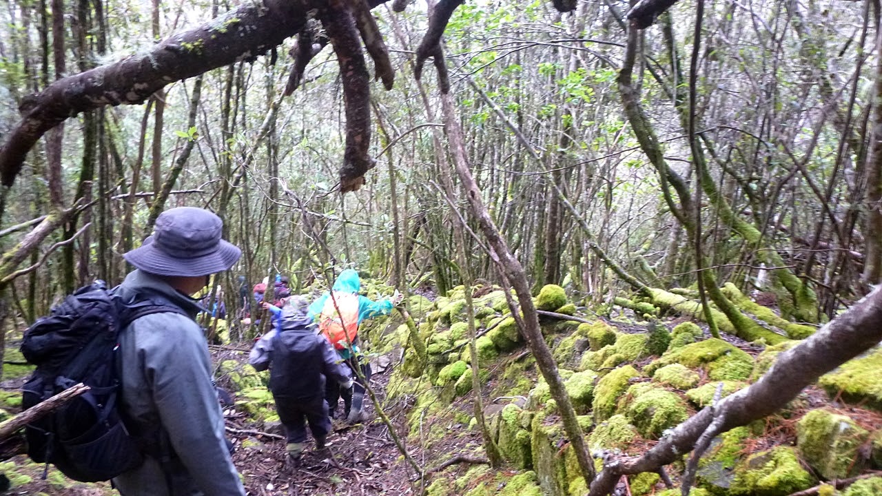
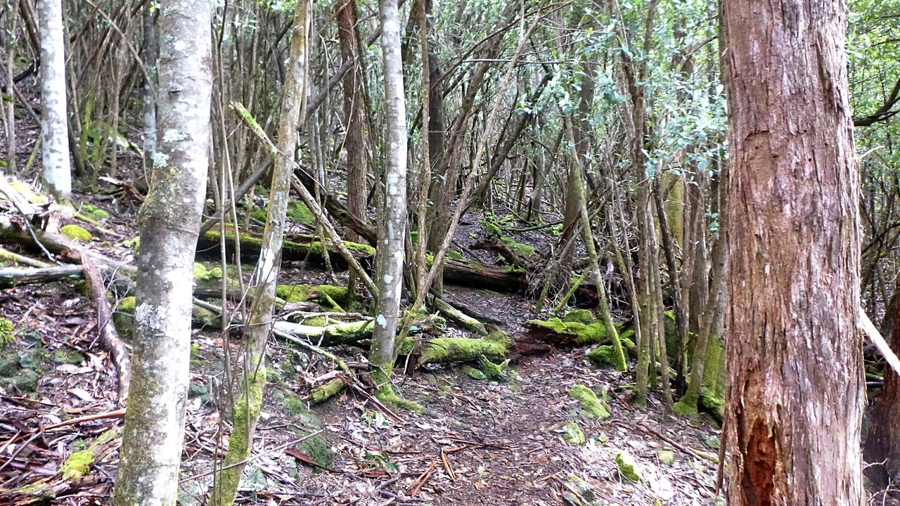
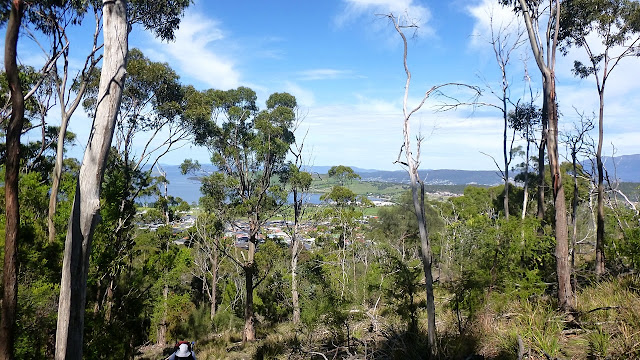
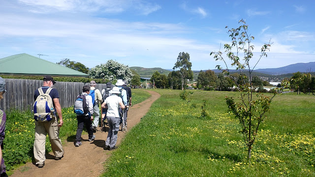
We'll see, but in the meantime, off we go. We, naturally, are heading away from the hills we expect to climb. Our route winds up through the houses and finally to a dirt path.


There are a few paths between and behind the houses

We're heading for that dirt track at the end
Now we start up hill, but not before putting two of Bob's claims to rest.


No wildlife claim - WRONG

No ruins - WRONG
That's two down and we've only just started.


We're gaining height rapidly

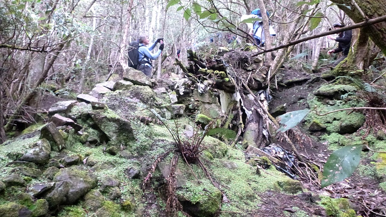
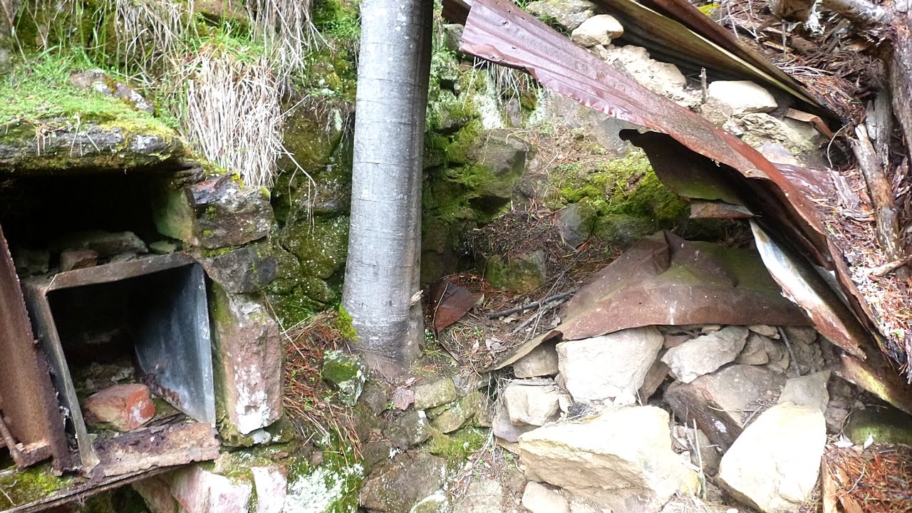
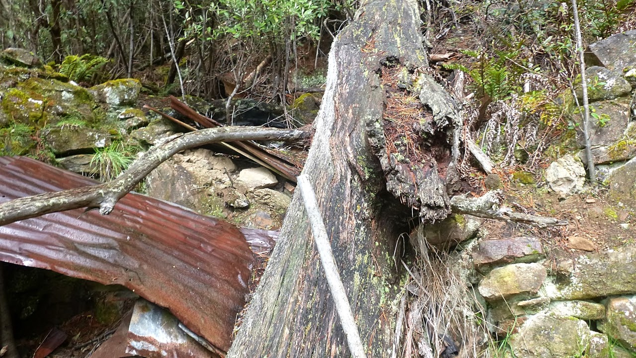
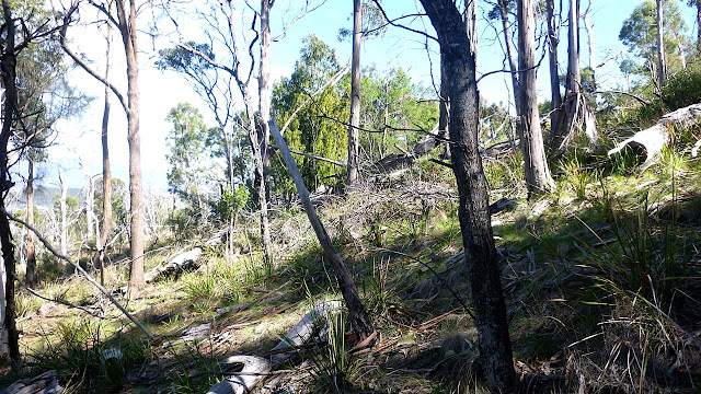
This land has had lots done to it over the years

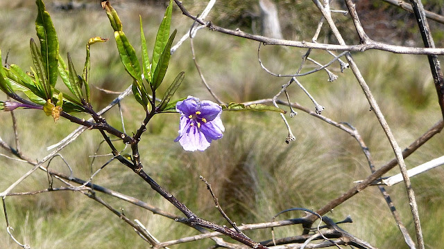
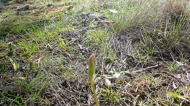
It may not be open and it may be blurred, but this is an orchid.  No flowers - WRONG
I'll declare No Birds to be - WRONG as we did see an eagle, but it was too far away for a decent photo. We continue up the old track until we reach a spot for Morning Tea.


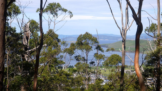
The views are getting better

Looking back
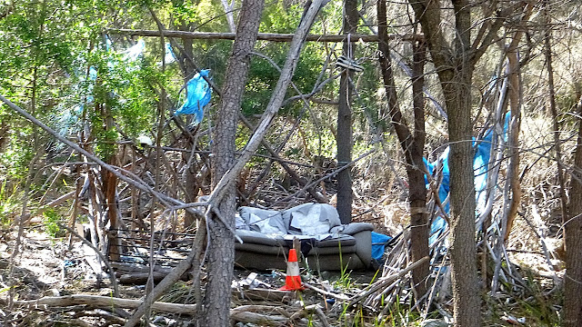
We reach a clear area to find someone has been here before us.

Bob stands watch as Kate and Renata relive their childhood


From here we head up Stanfield Hill for the promised views.

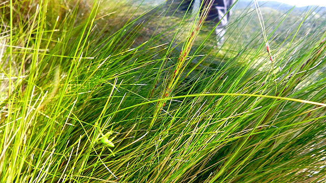
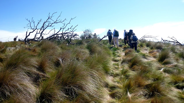
This hill is covered with tussock grass
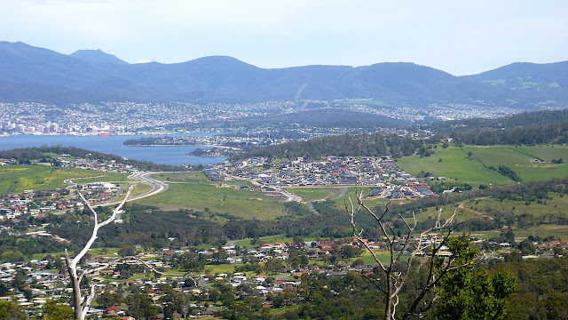
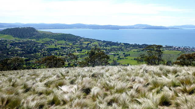
What can I say, the views are 360 degrees and fabulous. Bob was - RIGHT


Looking over Clarendon Vale

South over Acton

Single Hill and Acton
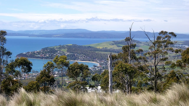
Roches Beach

Hobart
 We've been up almost all of the nearby hills (and some farther away) on our walks.

Bob offers us an extension of the walk and asks if anyone would like to wait here. No one does of course so off we go.

We walk down and pick up another farm track towards another hill.

Scraggly shrub with some flowers


Well hung gate?
I don't know what kind of stock this gate is supposed to stop, something about 2 metres high without the ability to crouch. Several of our walkers easily made their way under it.


They have interesting gates up here
 We stop here, enjoy the view and head back.


On the way back to the top of the hill, Peter spots this spider in the tussocks. Difficult to photograph as it was moving all the time, the camera doesn't do justice to its green colour. It was almost fluorescent to the eye, as bright as a safety jacket. I haven't been able to identify it.


Green spider in the grass
We return to the phone tower and set off downhill in a slightly different direction.


We pick up another track as we get lower and look for a place for lunch. We soon find it just before we enter the trees again.


Back among the houses
We come to St. Matthew's Church which dates back to when this area was known as Clarence Plains. We have plenty of time and decide to have a look at the graveyard, which proves interesting. There are a number of people who arrived with the first fleet.

Many seemed to live to quite a good age. There was one gentleman who died in 1858 at the age of 102. He was a bit of a goer as his wife was almost half his age.

There was also a familiar name among the stones: Bjelke-Petersen.


Dates back to the 1820s


The one below is interesting as it dates to around 1831. I think it was convict carved;  one who could carve stone but not spell very well.


Random use of capital letters, the number '4' is reversed, he forgot to leave room for 'life' at the end of 'Departed this' and couldn't spell January.

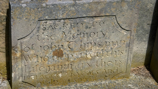
These two stones were probably at either end of a vault
He got the word 'Life' in, but still reversed the '4' and misspelled 'January'. It's the thought that counts.

I won't go into the history of the area, there is plenty of information available online.

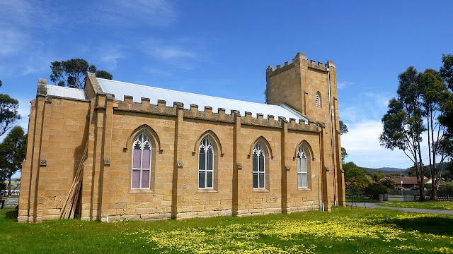
St. Matthews Church, Rokeby c. 1840
The church does have a fine pipe organ inside. It was built in 1824 for St. Davids in Hobart, but moved here in 1857 when Hobart got a new organ.

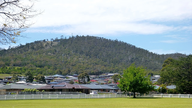
That's the hill we climbed
We are soon back at out cars.

Many of our walkers were/are keen bushwalkers and have acquired the best of equipment over the years. The photo below proves the point.


We had 13 walkers and covered 7.1km in 3:28hrs. A very good walk and Bob was true to his word re the quality of the views on top of Stanfield Hill.

Click here to download GPX file


Several of the walkers on the Mystery walk last week (Victors Garden) expressed interest in the Heritage inventories conducted by the Mount Wellington Trust. There are two volumes for the mountain and another just for the Springs. The web sites are below.

For the mountain
http://www.wellingtonpark.org.au/reports/


For the Springs
http://www.wellingtonpark.org.au/assets/wellingtonpark__springs_icp.pdf

Thursday 20 October 2016

Mystery Destination from (Victor's Garden) Tolosa Dam 2016

To paraphrase the Two Ronnies (showing my age) "It's a packed blog today!"

If you remember from the description of today's walk, Bob issued a challenge to me re my research skills to identify our destination. Also, I received an email from Bob in which he comes out of the closet, and will include details at the end of the blog.

We travel to Tolosa Park at Glenorchy and park just outside the gate to the Mountain Park. Construction of an enormous water tank is taking place on the opposite side of the road. Weather is cool with promise of showers.

Bob's mystery walk has attracted a good crowd
 We set off through the gates, past the shooting range and immediately Bob veers off into the bush onto a muddy track.

Into the bush

My new boots and I just laugh at these conditions
 We don't walk through them, just laugh at them.


Mt. Wellington
We're on open ground now and turnoff onto a bike track. Do the markings on the post mean bike riders can't read?


Bike track markers


We go bush and walk along until we join a track leading up


Now we're heading up


Off track again into the open bush
We've joined another bike track now

As you can see, the sun is out at the moment


There is a bit of colour in the bush


I hope Bob isn't planning Morning Tea at Junction Cabin
Fortunately, he wasn't. We walk along the North-South Track for a while before turning off onto an unmarked track leading up into the bush. It opens out at the top before continuing to climb.

Going up

I haven't been able to identify this. Fungus or mould?
The unmarked track leading up


The bush is very young here


Still going up

Very artistic cairn


The track is getting narrow and at this point Bob has to scout around to get his bearings as it's been a couple of years since he's been up here.

Bob's there in front of you if you know where to look

We're on track
There are some old orange tape markers on limbs here and there.

I can make out what looks like an old cairn

As I get closer, I can see it's the corner of two stone walls. At this point, I'll give you the results of my research as to what this is. Just as we arrive we are hit by a small hail shower.

Some have asked what methods I use to do my research. Professor Google is first choice. The older methods were much slower, messy and unreliable. Also, the supply of sacrificial virgins has become very unreliable.

No maps I had access to, including paper, had any reference to these ruins. It took a while before I found reference to Victor's Garden. Also known as The Temple and by some bushwalkers as Xanadu. The history is all anecdotal.

                                          *********
The Temple had 4-5 terraces and a hut. It's thought the main two story hut was built by Victor shortly after the 1967 bushfires. There was a main hut as mentioned, at the end of the terrace was a lean-to workshop. A bunkhouse on stilts, painted to blend into the bush, was also on the same level. There was a cultivated terrace with  a row of small pines (bigger now), two bee hives, a gate, a benched track and a man made water hole. Strawberries were reported as growing there by another visitor. Victor evidently kept an open house and there was a visitors book.

There are several ideas about the site pre Victor. 1. It was an old logging site. 2. That either during or immediately after WWII a sect established its self there, but abandoned it well before the arrival of Victor. This would fit with the name of "Theosophical Temple" given by the WPMT. That's the Wellington Park Management Trust. The Temple burned down c. 1985 and Victor moved to another hut he built.

Victor built Victor's Hut No. 2 after the fire and it's said he became a priest and returned to the Ukraine around 1988. There is an opinion that Hut No. 2 was the Temple. 

I found the following on www.bushwalk.com, by Swifty.

My goodness that goes back many years. I used to attend a high school at the top of Tolosa Street, from where we could see the roof of Victors Hut reflecting the sunlight from the lower slopes of Mt Arthur. We are talking 1977! Needless to say, we wagged school one afternoon and followed the fire trails in the general direction and found the place. It was decorated out with religious themes which changed every few months - Buddhist, Muslim, Christian at different stages, and yes there was a garden below, all fenced in. It was a double story hut, quite comfortable really. Heard a rumour that council eventually got the structure pulled down. I think we even met Victor there once, a special sort of guy.

                                          *********
It's amazing that it wasn't that long ago and so few facts are really known.

When we arrived and climbed the wall below. I immediately noticed a window opening in an adjoining wall with a bit of old clear plastic still attached. Thinking the walls were older, I put it down to more recent bushwalkers staying in the ruins. Later I saw a plastic pipe complete with valve leading from a higher water hole to a lower one.


Walkway on top of a wall


Many sheets of roofing iron lay around

Doesn't belong here

Old fireplace with bread oven


One of the hand dug water holes

Wolf spider lair in one of the walls

Many walls and diggings are to be seen off in the bush

A good view of Glenorchy


We're heading down another wall back to the track

Ron and I found a large well constructed drain leading through this wall
I find it difficult to believe Victor was responsible for all this construction. His hut, yes but not the rest of it. There must have been something here earlier.

Leaving the mystery behind, we continue on back to our original track.


Looking back
We reach a clearing and have lunch. Afterwards we return via a slightly different route to the North-South Track.

We leave the main track to take this one up hill


We take a mountain bike track down. It's a weekday and we're in little danger of being overtaken by anyone on a bike.

At the bottom, we take to the bush again before gaining a road leading down to the Mountain Bike Park where we make our way back to the cars.

We had 14 walkers and covered 10.66km in 4:58hrs. Total ascent was 1589 metres, so adding a kilometre for every 100 metres up makes it a good walk.
The fact that it was a mystery walk captured everyone's imagination.

I received a couple of emails from other walkers, but I didn't see them until late Wednesday night so I can claim I found the identify of Bob's mystery on my own.

I said at the beginning that Bob outed himself, so don't skip the rest of the maps but continue reading below them.

Click here to download GPX file


Now to Bob. Those of us who were on the walk not long ago at South Arm remember the orchid photographs trouble, well I've had an email from Bob saying he'd caught the disease from us and it caused him to take orchid photos on his recent visit to Bribie Island. You didn't think Bob was outing himself for any other reason, did you?
 Bob's Orchids: