Today we're starting from Lauderdale, heading to Cremorne. We may climb Calvert Hill to break the 18km barrier, but a change in plan means we'll hold that off for next time.
All the way from home to Kingston this morning I've been plagued by road works and it wasn't any different when we arrived at the car park at the end of the canal.
Workmen and shelters took up the parking so we had to go around and find another spot. Luckily, it wasn't too far away.
We set off for Roches Beach. I was quite prepared for today to be fairly miserable judging from the forecasts. It doesn't look bad at all as we head south on the beach!
 |
| If this is bad weather, bring it on |
 |
| Lots of seaweed has washed in |
 |
| North |
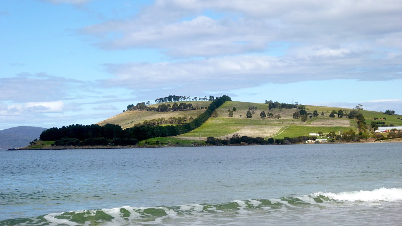
We're heading to and around Mays Point in the distance. We have some way to go before we can head up into the bush for the first track.
 |
| Into the bush around Mays Point |
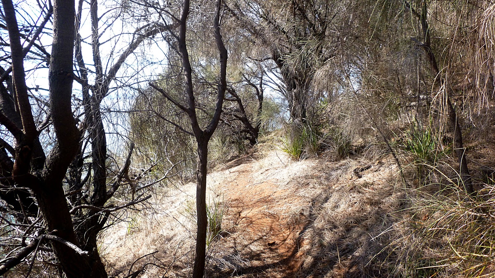
The track became more narrow and vegetation more dense as we go. I checked back several times, but could only see a couple metres back and assumed everyone was with us as I had seen them when we climbed up to the track.
Unfortunately, it was about this time when someone behind said "Where's the rest?". It seems I've now set a record by loosing just over half the group at one time.
Bob, who was at the back of our group, volunteered to go back and look. I mean, houses on the uphill side and water below, how lost could they be?
It all turned out o.k. as Bob returned with the lost walkers. Seems that they missed seeing us turn left onto the foot pad and , assured by two gentlemen who shall remain nameless that I was behind the group, kept climbing into someone's garden.
Back together again, we continued on. The track winds around and up and down but is easy walking.
I should clarify something at this point. I advertised this as an easy walk on flat ground. Just remember in future that my version of a flat walk is the equivalent of Bob's 'little hill' and you'll be alright.
On we go.
 |
| Every so often we get a break and a view of Frederick Henry Bay |
 |
| Sparkling sunshine on the water below |
 |
| That's Mays Beach below |
We make our way onto the track that heads down to the beach. There are steps installed, but you'd need rope and pittons to make it down from the bottom step.
 |
| Down the steps |
 |
| A short way down the beach we stop for Morning Tea |
The walk so far is one we've done in the past, so I was familiar with this spot.
 |
| There was a large beach over there, to the right |
|
|
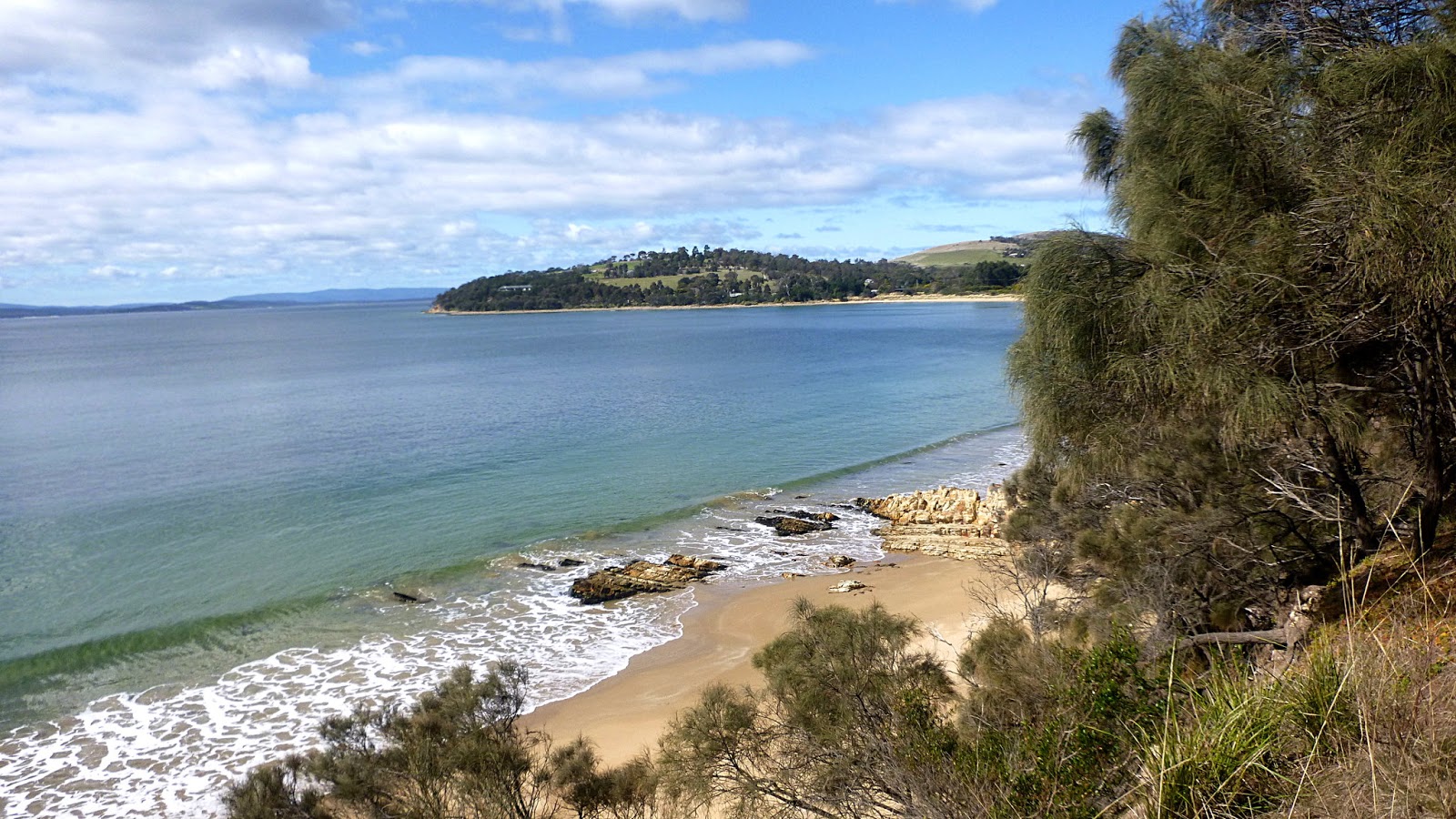
That was Sloping Main Beach.
Tea finished, we head on, walking on Mays Beach around Maydena Bay, heading for the distant point.
 |
| We're heading for that point |
 |
| Mays Beach looking south |
We reach the end, turning inland to pick up another track which will lead up.
 |
| Heading inland from the end of Mays Beach |
 |
| A look back. Not a bad place for a house over there |
 |
| The new track |
 |
| You only see them if you've had a 'special' drink |
 |
| Very nice property next to the track |
 |
| We're heading up and this is looking back |
We reach a junction, this is where the familiar track ends and we start off in a new direction. You can't see, but on our right is a property that has a garden railway running around it. That should identify the spot for others that have been on past walks here.
 |
| We turn left into new territory |
It was a steep decent and will make an entertaining climb when we return.
We continue along the shoreline until we find a faint track heading along the waterline. We take it to see where it goes.
 |
| The rocks become larger as we go, slowing us down |
 |
| Renate performs her well known imitation of Hercules and widens the gap for us to pass... |
 |
| ...unfortunately we reach a point we can't pass |
This barrier was larger than it appears here. Vertical sides and high tide prevents us from passing. There was another way behind us that seemed to lead up, but it was too dangerous to attempt. The rocks here had been rolling around for many years and were worn perfectly smooth.
The decision was made to turnaround and walk back.
 |
| We return, scanning for a way up |
 |
| I waited ages for a big splash, but had to move on |
 |
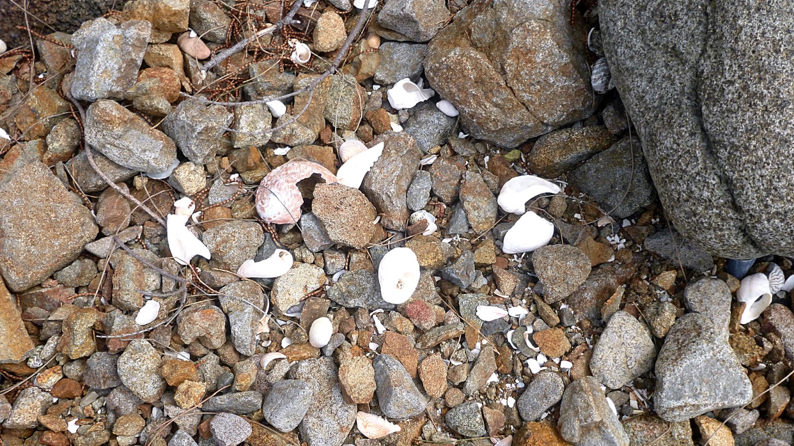
| Many interesting shells among the rocks |
Just as I took this photo, Ron called out to say Bob had found a way up. The photo below makes it look easy, but it was a steep climb, requiring careful foot placement and checking on your handhold as some rocks were loose.
The group took in their stride, so we pioneered a new route from the beach to the higher track. Lunch was taken at the top which had a comfortable grass covered slope, great views and sunshine.
Lunch finished, we carried on. Wide track, pleasant walking and views.
Soon we reach the Calvert Hill Nature Reserve. Bob was really glad to get here and we had a hard time getting him to leave this sign.
Dogs are banned, but obviously horses and cattle aren't. You had to be very careful where you stepped because of all the impressive mounds left behind by those animals.
 |
| First sight of Cremorne |
After a while we went through another gate and were getting closer.
 |
| Pipe Clay Head in the distance |
There is water between the head and Cremorne which is the entrance to Pipe Clay Lagoon.
 |
| Cremorne Beach |
 |
| Arrival |
 |
| Some of the group are going to visit the public toilets |
I've not been to Cremorne before, so I tag along. Lots of houses here, some look expensive.
We return, gathering the others up to make our way back.
 |
| The return |
 |
| Do they share the one coat? Or is that horse worth more than the rest? |
The steep hill I mentioned sometime ago was just as steep going up, but was soon concurred, and we made our way back to Lauderdale.
We had 13 walkers and covered 17.03km in 6.25hrs. That includes stops.
The Track Report shows a satisfying number of 18% and over grades, and the total ascent is 915 metres, so you can add 9km to the total walked if you want.
Click here to download GPX file